Drone Photography Sydney Australia
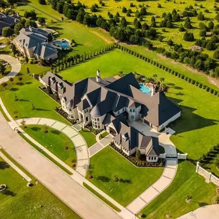
Show your property and its surroundings from above with aerial photos and video planned around the location.
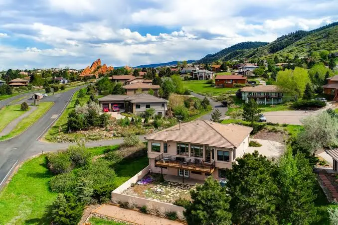
Show your property and its surroundings from above with aerial photos and video planned around the location.
Agents and developers marketing properties where location, land and surrounds are a primary selling point.

We confirm operational feasibility, restrictions and safe take-off zones before promising shots.
Key angles that explain land, aspect and nearby amenities are prioritised.
Flights are executed with redundant coverage for the hero angles you need.
Selects are finished to sit alongside interior and twilight photography.
Our Drone & Aerial Shoots portfolio
Explore our service examples. Select an image to view it in full.
Why teams trust us with Drone & Aerial Shoots
- 01
One shoot, every asset
Stills, aerials, video and spatial capture in a single visit — less vendor disruption and a consistent look across the campaign.
- 02
Portal-ready delivery
Correct ratios and file sizes for major listing platforms, print and social, delivered on an agreed turnaround.
- 03
Accurate, not oversold
Editing that flatters the property without misrepresenting it, which protects both the agency and the vendor.
Questions about Drone & Aerial Shoots
How can drone photography help market a property?
Aerial images can show land layout, surroundings and features that are difficult to communicate from the ground. They are most useful when that wider view adds meaningful context. Ground photography is still important for showing rooms and detail.
Can a drone shoot be carried out at any property?
No. Location, airspace, nearby people and operating conditions can restrict a flight. The site must be assessed against applicable CASA requirements before a booking is confirmed. An alternative approach may be needed where flying is unsuitable.
What should we provide before booking an aerial shoot?
Provide the property address, access details, desired shots and deadline. Note nearby obstacles and any known site restrictions. This helps assess feasibility and plan useful coverage before committing to a flight.
Are drone photos and aerial video both available?
Photos and video can be included in the agreed scope where the location and conditions allow. We confirm the output list and editing requirements first. Aerial video production may involve more work than a still-photo shoot.
How does weather affect drone photography?
Wind, rain and visibility can make flying unsafe or reduce image quality. Conditions need to be checked close to the shoot. We agree rescheduling arrangements in advance so safety and a useful result guide the decision.
What approvals or operator requirements apply to drone work?
Commercial drone work must meet the applicable CASA requirements for the operator, aircraft and flight. Those requirements vary with the operation. They should be checked during planning rather than assume every drone job needs the same licence or approval.
Can aerial images show boundaries and nearby amenities?
Annotations can be scoped if you provide reliable information to check against. Boundary graphics should not be treated as a survey. Labels must be clear and accurate so the image helps explain the listing without overstating distances or features.
What determines the price of a drone property shoot?
Cost depends on location, feasibility, travel, required outputs and editing. Permissions or complex logistics may add work. A site review is needed before confirming the scope, price and practical scheduling options.
Talk to us about Drone & Aerial Shoots
Bring the brief, the budget or just the problem. You will get a straight answer on scope, timing and whether this is the right service for it.